I keep going back to the beginning of this thread to try and make sure that i do not post any images or information which has previously been posted.................sigh....unfortunately i have seen where i have failed miserably in that endeavor. I once again apologize for (past, present and future), transgressions........
I did see the following posts from back in October, and just wanted to clarify actually what this photo is capturing.......
Quote:
Originally Posted by ethereal_reality

OK, the caption on this photo was
"looking southwest from 1st and Clay Street."
But isn't this the west entrance to the 3rd Street tunnel? (I recognize the 3-story building from previous pics)
Obviously many buildings have already been torn down.
But where's 2nd Street then? And I can't find Clay Street on the map I have.
Perhaps it was mislabeled.
usc digital archive |
Quote:
Originally Posted by sopas ej
Actually, I think it is mislabeled. I see where this is. Clay Street no longer exists, it was obliterated when Bunker Hill was regraded. I think this is actually 2nd and Clay. The 2nd Street tunnel also exists, underneath the hill; the 3rd Street tunnel is shorter than the 2nd street tunnel, the hill is irregularly shaped.
|
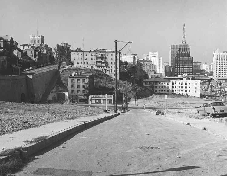
This is actually a photo of Cinnabar street, which was a one block street that ran from 2nd to the 3rd street between flower and hope.
Beaudry had posted this map of Bunker Hill back in November which shows the location of Cinnabar street.

In the aerial image that i had posted in response to Threehundred looking for photos of bunker hill during the redevelopment process, you can see Cinnabar in the middle left of the photo. (i could say it's the street with no buildings, but that would be like saying it's the storefront in chinatown with the duck hanging in the window)
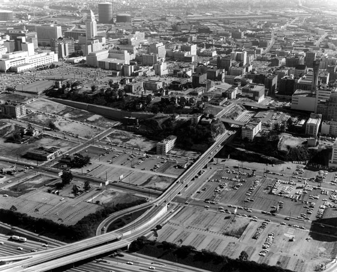
the photo that was posted by ethereal_reality was taken about the same time as the aerial, 1965
here is an image taken looking south from a similar angle, (note the Richfield tower), in 1960 before the wholesale demolition began

USC Digital Archives