Quote:
Originally Posted by HossC

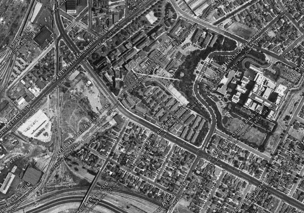
My guess would be the open area on the center-left of this 1948 aerial (the Medical Center is center-right). The empty space, located just below N Mission Road, and formally known as the Orange Slope Tract, is now under the Golden State Freeway. We covered it in post #25064 because of its proximity to the Los Angeles General Hospital Tuberculosis Unit.
Historic Aerials |
The empty lot in the aerial is too far west and too close
By the perspective, the field should be out of the erial, bbottom center. IIt appears to me that the gulch that contained Ramona and the PE is at the far edge of the field in the palm tree pic.
When was the Gen Hospital built? It looks new in the pic