 Posted Mar 17, 2014, 6:18 PM
|
 |
Registered User
|
|
Join Date: Feb 2014
Location: French Valley, CA
Posts: 8
|
|
Quote:
Originally Posted by GaylordWilshire

 USCDL USCDL
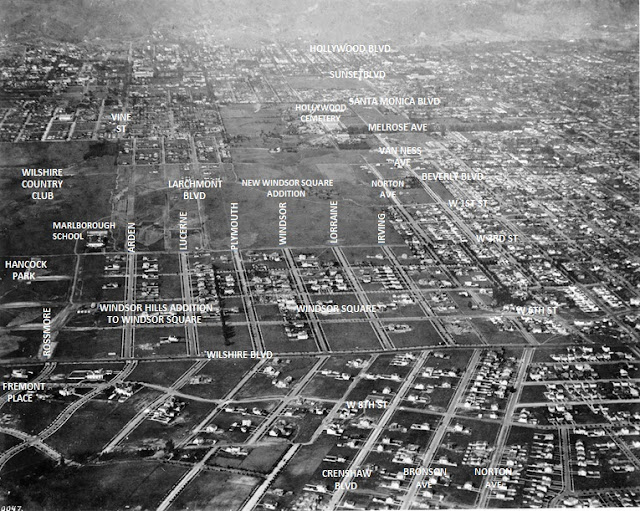
My labels on an aerial that must date from between 1916, when the Marlborough School moved to 3rd Street from 23rd, near St. James Park, and 1920, when the third part of Windsor Square opened (above 3rd St and between Larchmont and Irving, north, more or less, to Beverly Blvd. (Btw, at this point Beverly was still called Temple on insurance maps.)
The north-south line of trees between Plymouth and Lucerne marks the boundary of the first two sections of Windsor Square... somewhere in the noirish past I posted some pics showing how the surfaces of some east-west streets change abruptly at that boundary--concrete in Windsor Square, asphalt in the Windsor Hills addition....
Since I went a little overboard with the labels, here's the original shot...
 USCDL USCDL
(USC has identified this shot as including a view of West Adams. It doesn't.) |
Thank you!!!! I know this was posted a while ago, but I was able to locate a house that I recently worked on on Lorraine. Weird to see the area with NO trees!!!!
|