Quote:
Originally Posted by ethereal_reality

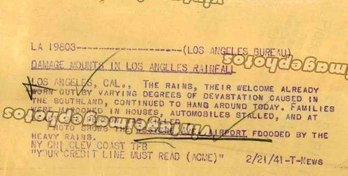
-still more rain in 1941.
February 21st to March 4th! (in these two examples)
Western Ave. Airport?
 ebay
__
|
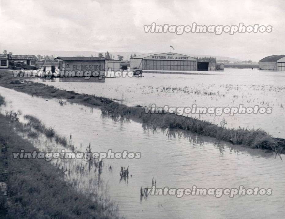
There was an airport on the west side of Western Avenue just north of Rosecrans Avenue from about the late 1920s until the early- to mid-1950s. It was mostly known as Dycer Airport, Western Avenue Airport, and finally Gardena Valley Airport, although it also had other names.
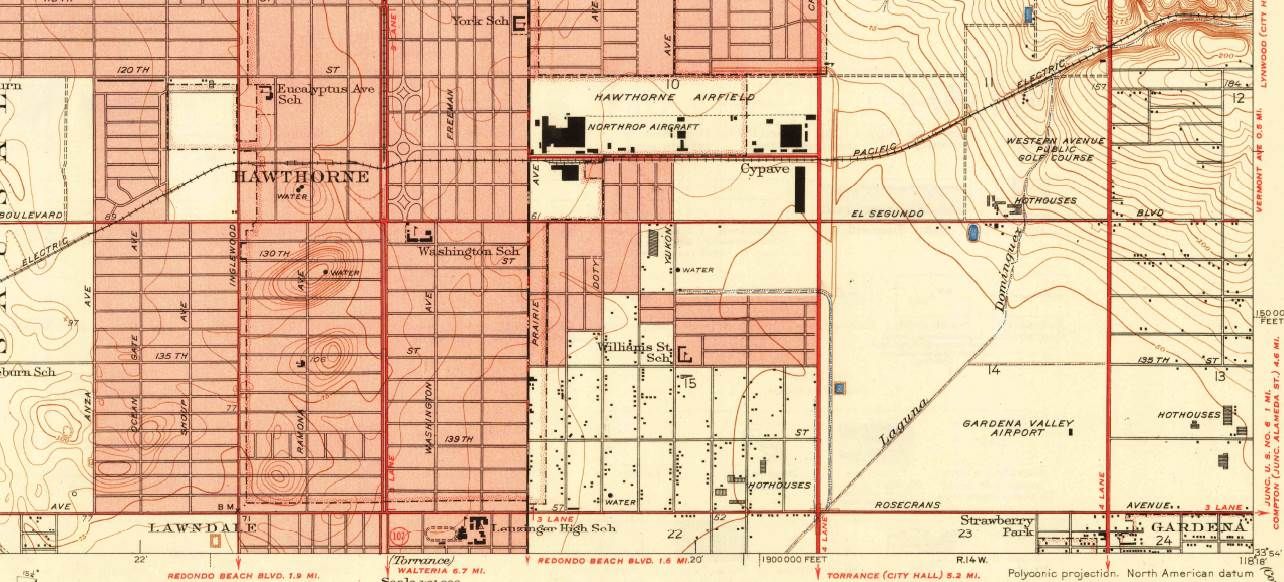
1930 Inglewood USGS; the airport is in the lower right corner:
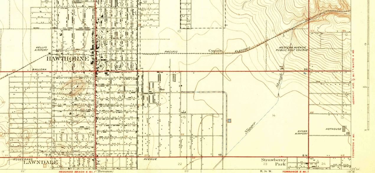
USGS --
http://geonames.usgs.gov/pls/topomap...25509::NO:RP::
1930 airport flooding, looking north on Western from above Rosecrans:
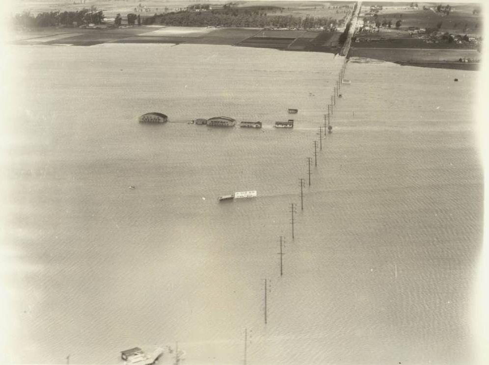
USC Digital Library --
http://digitallibrary.usc.edu/cdm/si...id/10234/rec/1
A rare dry view from 1931, looking northwest at Rosecrans and Western, with the hangars on the right:
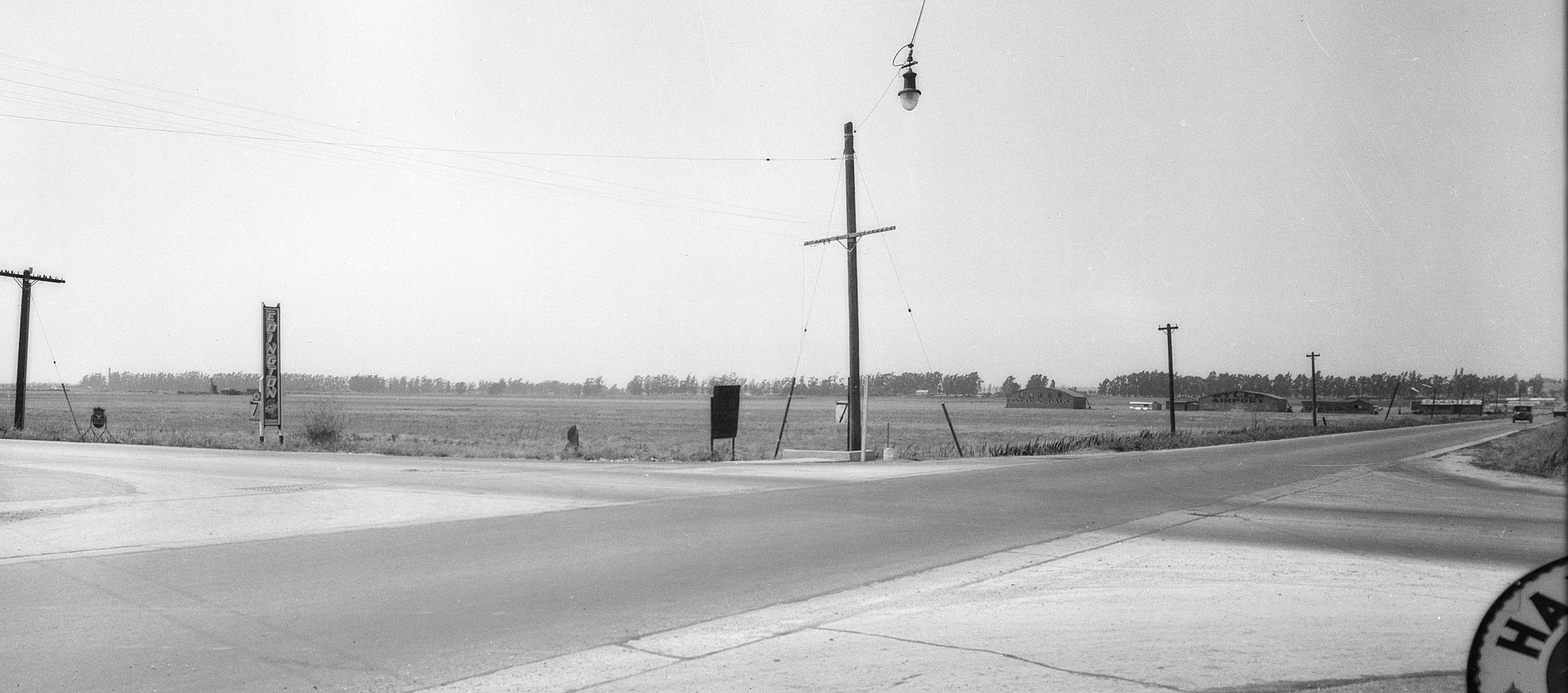
USC Digital Library --
http://digitallibrary.usc.edu/cdm/co...id/28299/rec/2
1938 airport flooding, looking east along Rosecrans. The hangars are circled. The diagonal line across the photo just below the circle is the slough (that section of the slough has since been realigned):
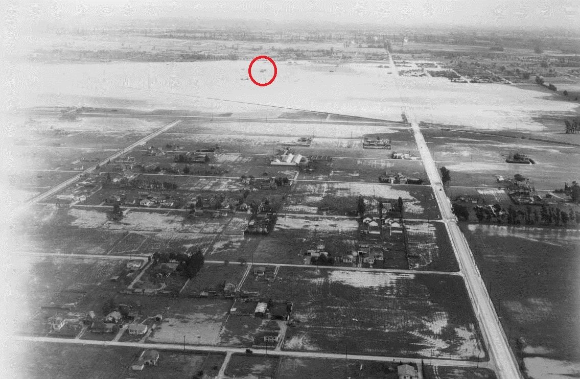
USC Digital Library --
http://digitallibrary.usc.edu/cdm/si...d/3397/rec/252
February 1939 airport flooding, looking south on Western:
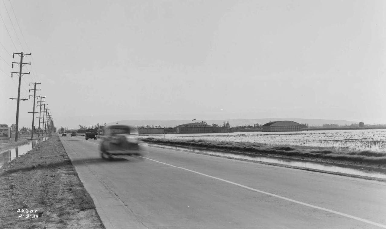
Huntington Digital Library --
http://hdl.huntington.org/cdm/single...id/33695/rec/4
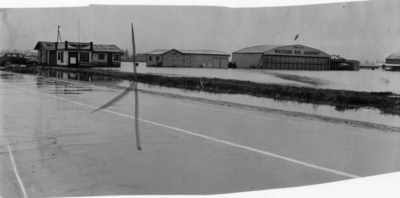
More February 1939; water up to the hangars:
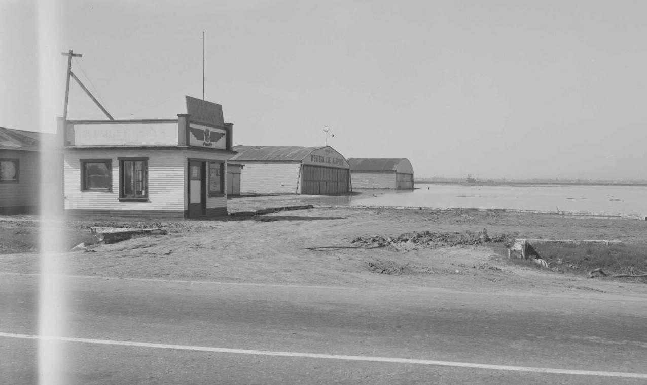
Huntington Digital Library --
http://hdl.huntington.org/cdm/single...id/33696/rec/5
Western Avenue Airport apparently became the Gardena Valley Airport on October 21, 1939:
http://www.aerodacious.com/Pix/Ded-CA-l155.jpg
This photo is dated 1940:
LAPL --
http://jpg1.lapl.org/pics47/00043320.jpg
1948 Inglewood USGS; now it's the Gardena Valley Airport, but it's still in the lower right corner:
USGS --
http://geonames.usgs.gov/pls/topomap...25509::NO:RP::
Close to the end, 1952. That's Rosecrans and Western in the lower right corner; the airport is bounded by Western, Van Ness, 135th, and 139th:
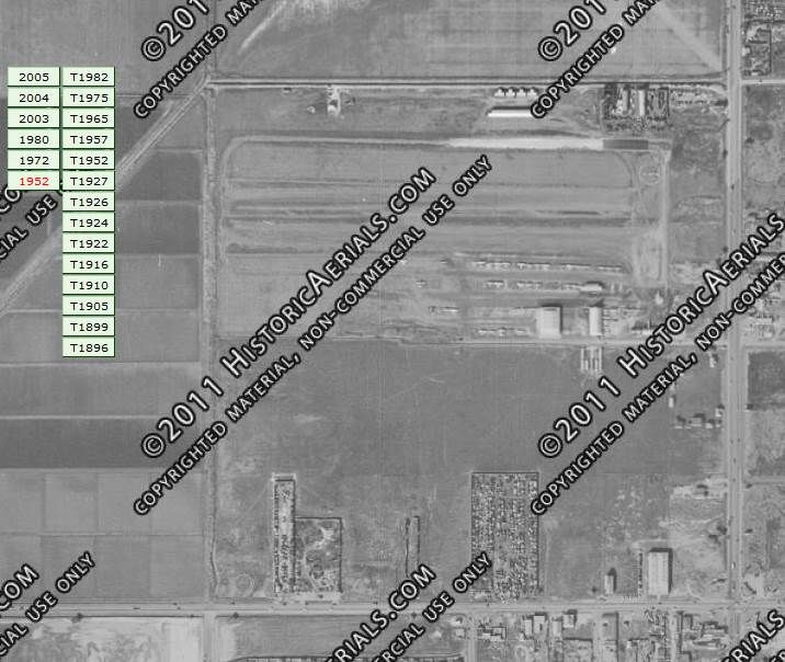
Historic Aerials.com --
http://www.historicaerials.com/
Info from, and more info at:
http://www.airfields-freeman.com/CA/...#gardenavalley