Scenic Hikes in Los Angeles
-Mount Lee & Hollywood Sign (34.13441,-118.32187)
-Mount Hollywood (34.12821,-118.30111: Griffith Observatory+Downtown LA+Silver Lake) (& 34.12851,-118.29441: Downtown Glendale+Downtown LA)
Quote:
Originally Posted by desertpunk

|
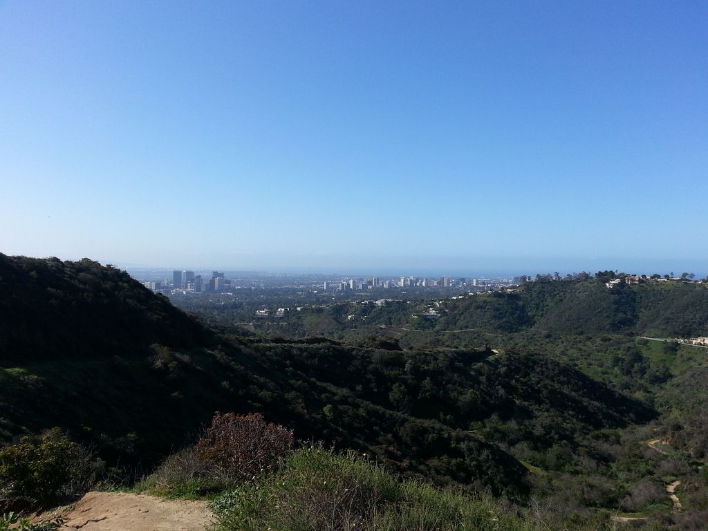
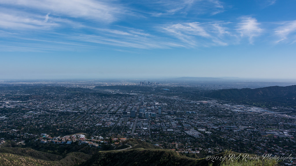
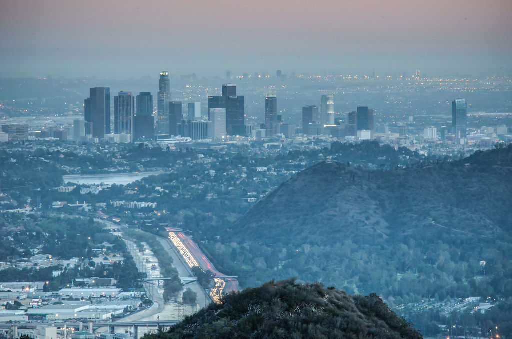
-Runyan Canyon Loop - Runyan Canyon Park (34.11086,-118.34872)
West Trail: 34.11141,-118.35352 (Highest Point) - Downtown LA + Hollywood + Century City + Westwood + Hwy 101 + Sunset Strip
East Trail: 34.11086,-118.34872 (270 Degree View) - Downtown LA + Hollywood + Century City + Westwood + Hollywood Sign
Quote:
Originally Posted by ToneFloat
From tz5b's flickr stream:
From Runyon Canyon:
 |
Quote:
Originally Posted by Munichpictures1970
|
-Mt. Hollywood Hiking Trail from Griffith Observatory (34.12821,-118.30111)
Quote:
Originally Posted by Kenny
|
-Betty B. Dearing Trail (34.1331,-118.4039)
San Fernando Valley and Universal City
-Hastain Trail at Franklin Canyon Park (34.1114,-118.4151)
Century City and Westwood
-Inspiration Point at Will Rogers State Park (34.05973,-118.51379)
Downtown LA + Century City
Quote:
Originally Posted by Kelbeen
|
Quote:
|
Originally Posted by Metro - Los Angeles County Metropolitan Transportation Authority - The Source
|
-Los Liones Canyon Trail (34.0571,-118.56007)
Above the Pacific coast of Los Angeles (Santa Monica+Westwood)
Quote:
|
Originally Posted by svanes
|
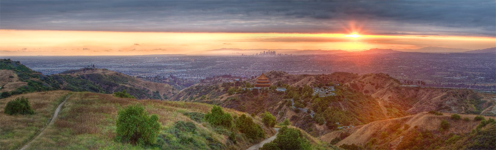
-Echo Mountain via the Sam Merrill Trail (34.21094,-118.12079)
Downtown Pasadena & Downtown Los Angeles
-Henninger Flat via Mt Wilson Toll Rd (34.19451,-118.08965)
Downtown Pasadena & Downtown Los Angeles
Quote:
|
Originally Posted by From lamb1028's flickr stream
|
-Ernest E. Debs Regional Park(34.09915,-118.19956 & 34.09463,-118.19664)
Downtown LA
 http://www.flickr.com/photos/attgrl/6287158533/
-Verdugo Mountain - Las Flores Mtwy (34.1829,-118.2503)
Downtown Glendale & Downtown Los Angeles
 Glendale, California
 by
RobRovira, on Flickr
-Verdugo Mountain - Beaudry Loop via Beaudry South Mtwy
(34.18661,-118.25670) Communications Tower
Downtown Glendale & Downtown Los Angeles
Quote:
|
Originally Posted by From fai_11's flickr stream
|
Quote:
|
Originally Posted by From fai_11's flickr stream
|
-Verdugo Peak via Wildwood Canyon Trail
Trailhead: 34.2028,-118.2986 (Wildwood Canyon Park)
Burbank & Downtown Los Angeles
 Los Angeles at Sunset
 by
nikhilo, on Flickr
-Glenoaks Canyon (34.1463,-118.2105)
Downtown Los Angeles & Downtown Glendale
 Green mountain
 by
Lucas Janin | www.lucasjanin.com, on Flickr
-Cherry Canyon Trails - Flint Canyon Trail
(34.16856,-118.21982) Downtown LA + Downtown Glendale + SR-2 / SR-134 Interchange
Quote:
|
Originally Posted by Googiesque
|
-Encino Reservoir & San Fernando Valley (34.13070,-118.51051)
park the car at 34.13039,-118.50237, walk along Mulholland Dr (30-minute hike)
-Canyonback Trail (34.13070,-118.51051) (over Bel Air)
-Turnbull Canyon Trail (34.00087,-118.01265)
 Turnbull Canyon Sunset
 by
waynewhuang, on Flickr
-Skyline Trail Loop in Puente Hills
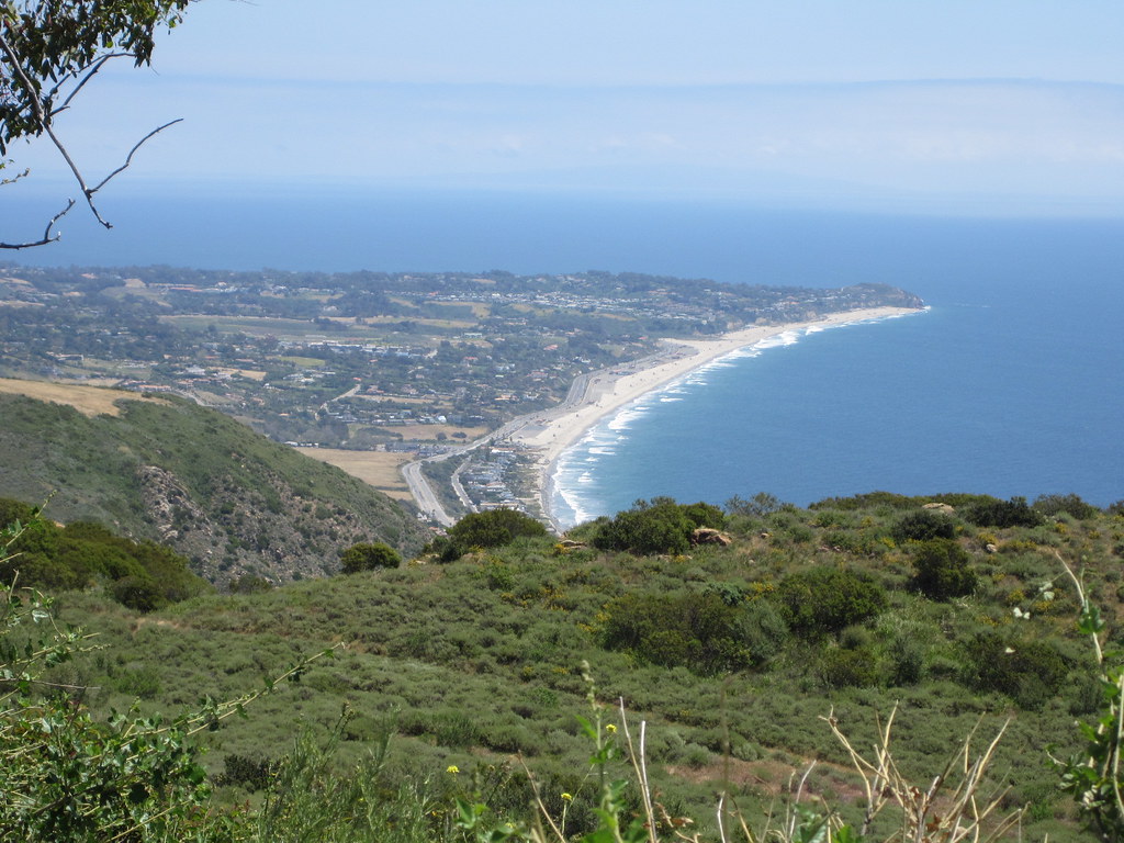
-Ocean Overlook at Charmlee Wilderness Park (34.04738,-118.8793)
Malibu
 http://www.flickr.com/photos/kristinabliss/5701492914/
-Zuma Ridge (34.03883,-118.8226)
Malibu
-Mount Rubidoux
Downtown Riverside
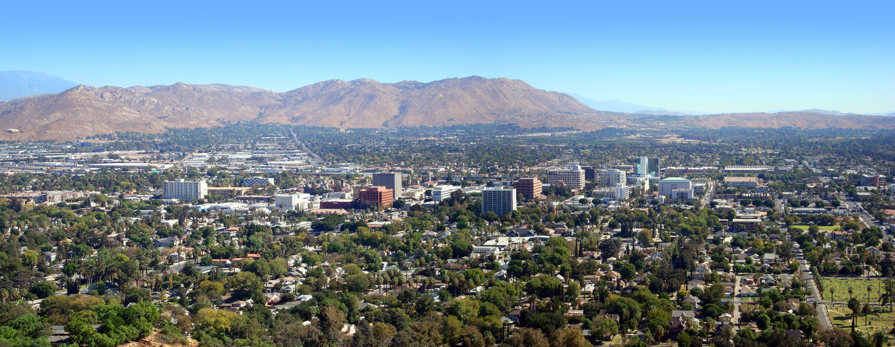 Downtown Panoroma
 by
dmvcomics, on Flickr
-Azusa Peak via Garcia Trail (34.15605,-117.88827)
-Claremont Hills Wilderness Park
-Fullerton Panorama Trail
-East Ridge View Trail in Peters Canyon Regional Park
(33.7734,-117.7606 & 33.7592,-117.7696)Peters Canyon & Peters Canyon Reservoir
-Turtle Rock (33.6498,-117.8097 & 33.6418,-117.8018)
Irvine, Costa Mesa, & Century City
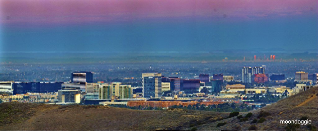 Century City to Hollywood Sign from Irvine P3360360 c Stitch-002
 by
moondoggie71, on Flickr
-Water Tank Rd at Laguna Coast Wilderness Park
33.55214,-117.78795
33.55388,-117.78904
33.55692,-117.78783
-Moro Ridge at Crystal Cove State Park (33.56,-117.8126)
Parking at El Moro Visitor Center (33.5613,-117.8216)