While looking for old maps to aid my Lookout Mountain investigations, I came across this online exhibit of L.A. Maps on the Library Of Congress site. I couldn't find anything with detail on Laurel Canyon, but there are some other interesting maps, including a 1912 entry they call "Ghost Suburbs of L.A." That map shows Garvanza along with dozens of other surprising "towns" including, down by Robertson and Wilshire, places called Arnaz and (ahem) Gayland. The site seems a good resource, though online availability of some maps is pending.
http://www.loc.gov/exhibits/lamapped...d-exhibit.html
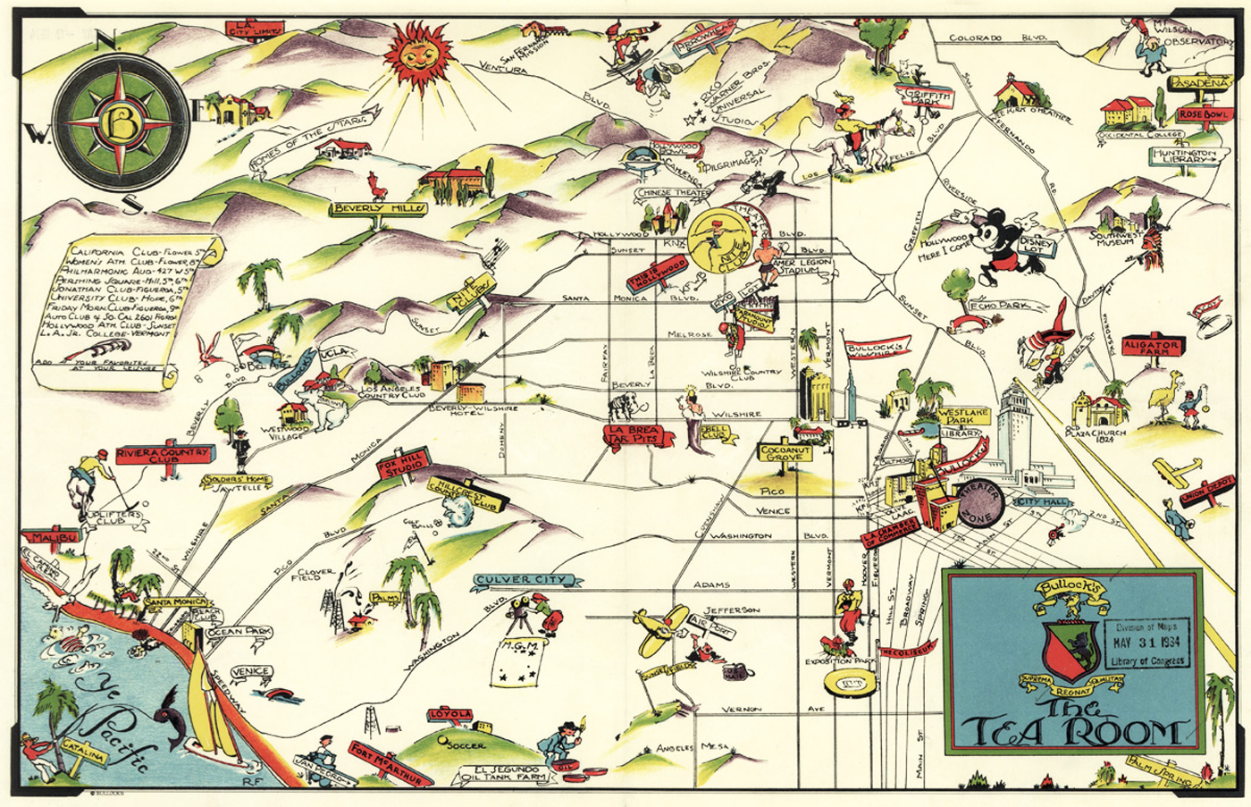
Here's a 1934 paper place map from Bullock's Tea Room that I liked.
 http://www.loc.gov/exhibits/lamapped...d-exhibit.html
Here's another good resource for old L.A. maps
http://hypercities.ats.ucla.edu/