Quote:
Originally Posted by ScottyB

Don't know if this provides any clarity on hills, but an interesting view from the Courthouse looking W.....I think that would be Temple running from the viewer, but please enlighten me anyone- what is the large building at the upper right of the photo? And, interesting to see the derricks on what I think is Bunker Hill (again, correct me if I'm wrong!).
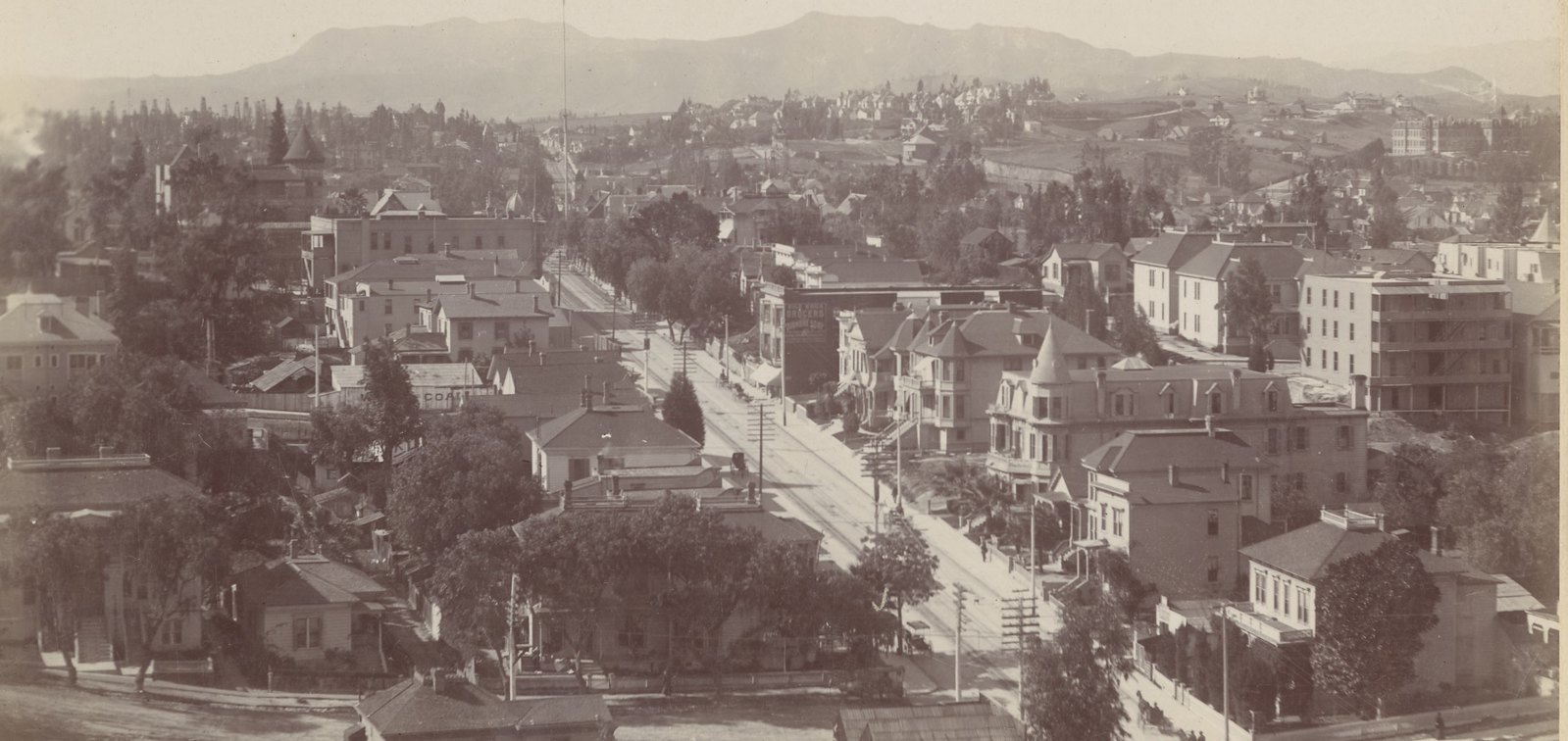
CSL |
The oil derricks are west of Bunker Hill, more or less in the area around Court and Toluca Streets, I guess. At upper right
must be the Sisters' Hospital aka Los Angeles Infirmary.
The Seaver Center says this photo of Sisters' Hospital, looking at the front of the building, was taken in 1886:
 "The Sisters Hospital"
 @ Seaver Center
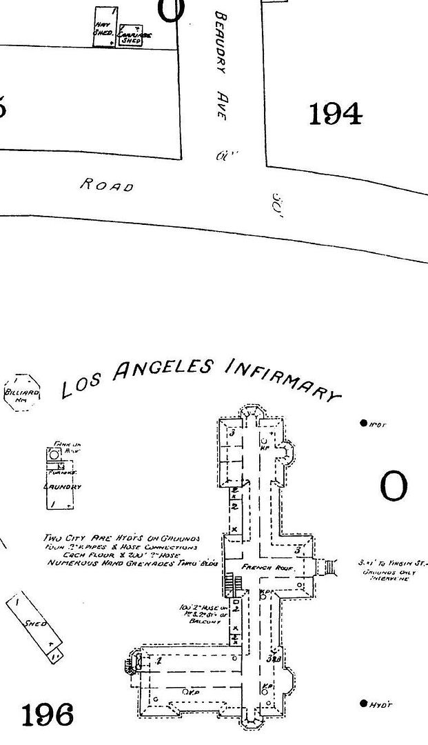
1888 Sanborn:
ProQuest via LAPL
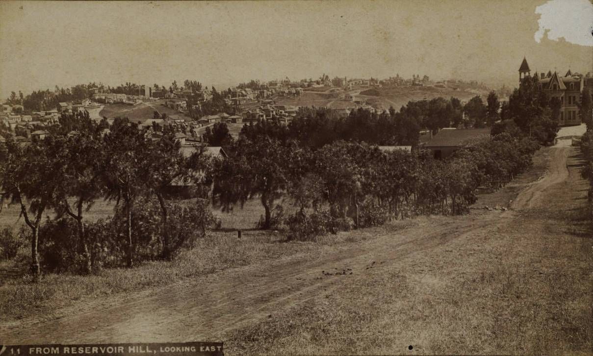
Here's a photo of Sisters' Hospital that I don't think we've seen before. It is dated c. 1886-90 and looks SE from N. Beaudry
down at the hospital on the right. The west sides of Fort Moore Hill and Bunker Hill are visible in the distance:
486753 @
Huntington Digital Library
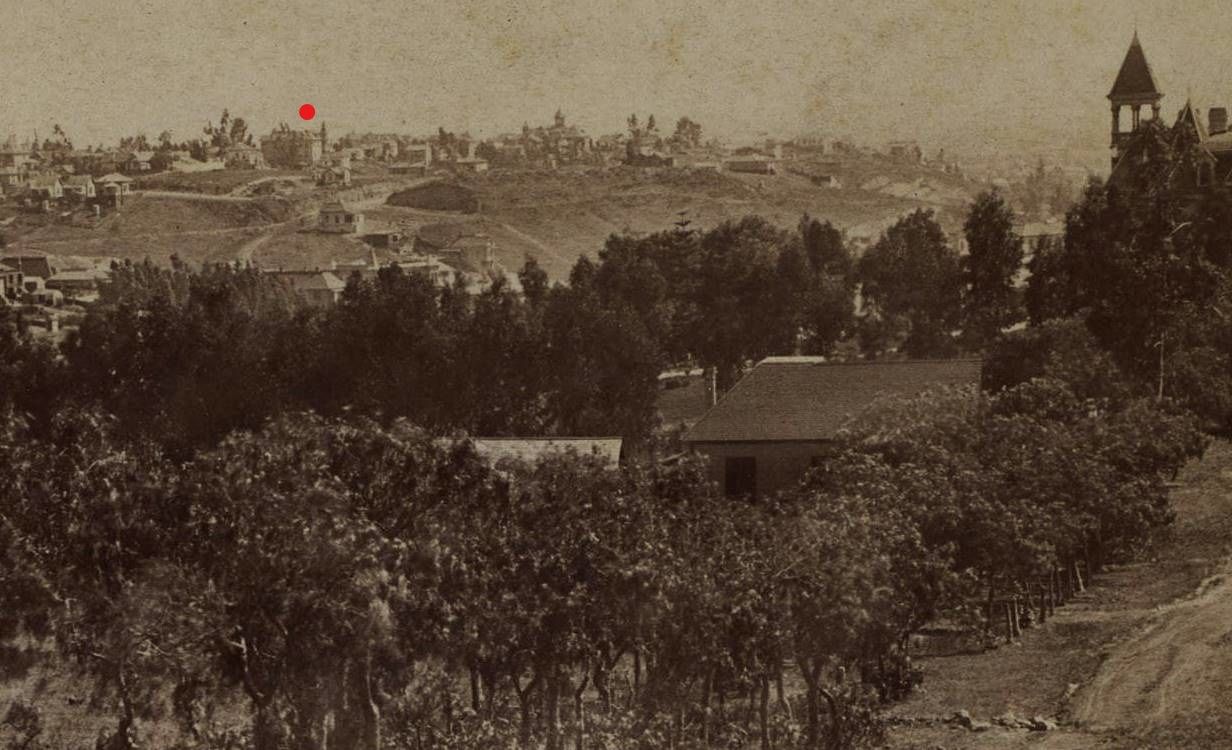
This is a close-up from the above photo. I have placed a red dot over what I believe is the
F. U. Berke residence
at the NW corner of 2nd Street and Bunker Hill Avenue:
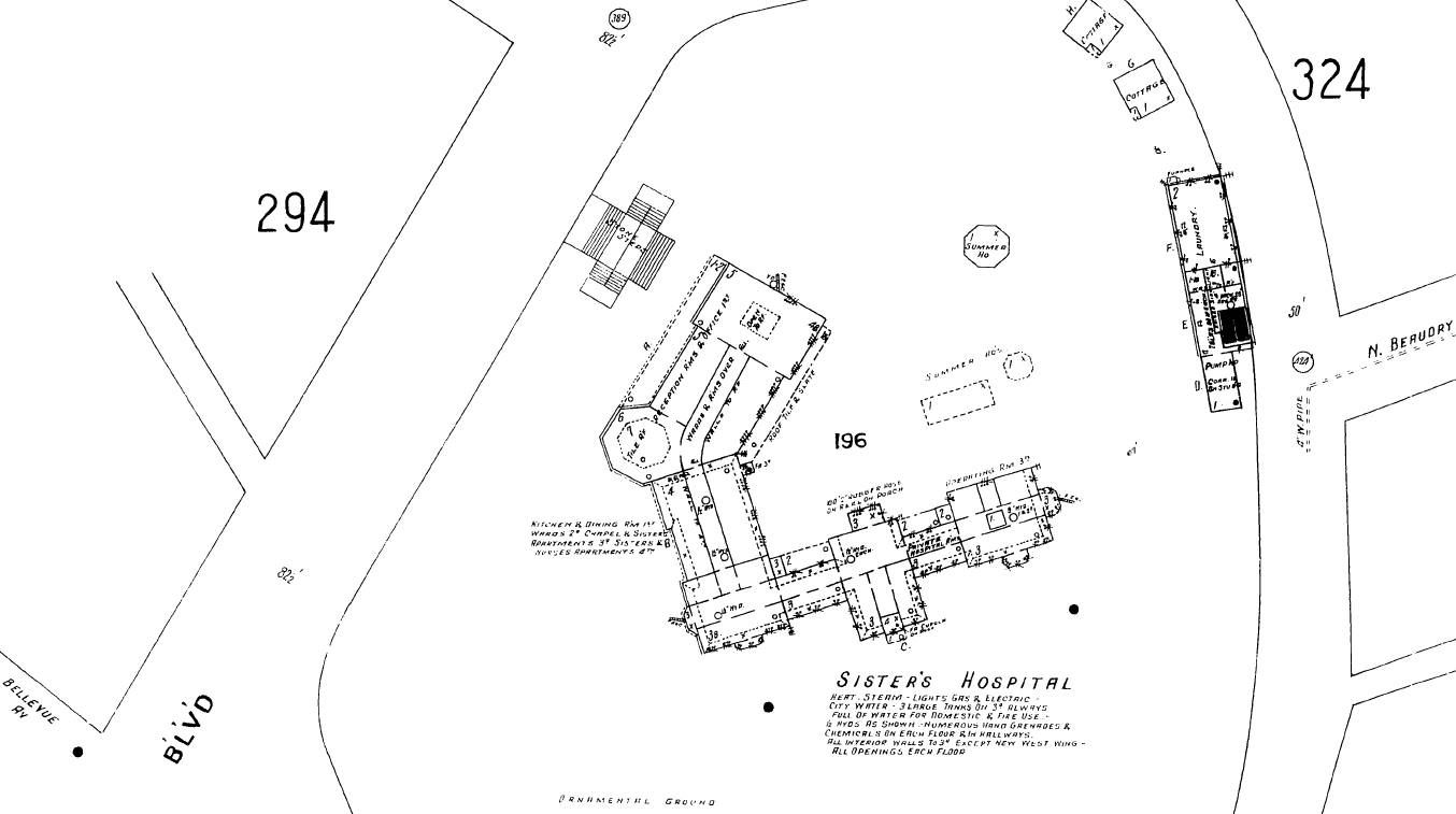
Below is the hospital on the 1906 Sanborn. I believe the angled wing at the top was built in 1901-02. The BLVD marked
at lower left is Sunset Blvd. I think what's marked N. Beaudry here (and on the 1888 map) is now White Knoll Drive:
ProQuest via LAPL
This postcard view shows the 1901-02 wing (I believe the hospital was remodeled at the same time) from Sunset Blvd.:
Quote:
Originally Posted by westcork

Cardcow
|