Quote:
Originally Posted by ethereal_reality

Below: A rare view looking northeast from the County Courthouse tower, circa 1900.

usc digital archive |
Excellent!!! I have an old postcard made from this exact image. I haven't seen the original photograph before now -- woohooooo!

And you're exactly correct - this is the NE view from the Court House tower right around the turn of the last century.
Just to give people some bearings here - the wide avenue in the background pointing almost straight at us is Aliso Street, which today is the alignment of the 101 freeway east of the Civic Center. It turns slightly to our left then and becomes The Slot as it passes through the site of the Baker Block - that long building at center-left with the three large cupolas.
Also, down at the lower right can be seen a portion of Temple Square - the "Times Square" of old L.A. And at the extreme right edge you can just barely see a corner of the Temple Block - one of the most important buildings in the early political and commercial life of the city.
If we could look at this same scene today, the north wing of City Hall would be just out of view past the right edge of this photo.
Now, let's fly down to Temple Square and go forward in time about 30 years. This is what you'd see looking south down Main Street:
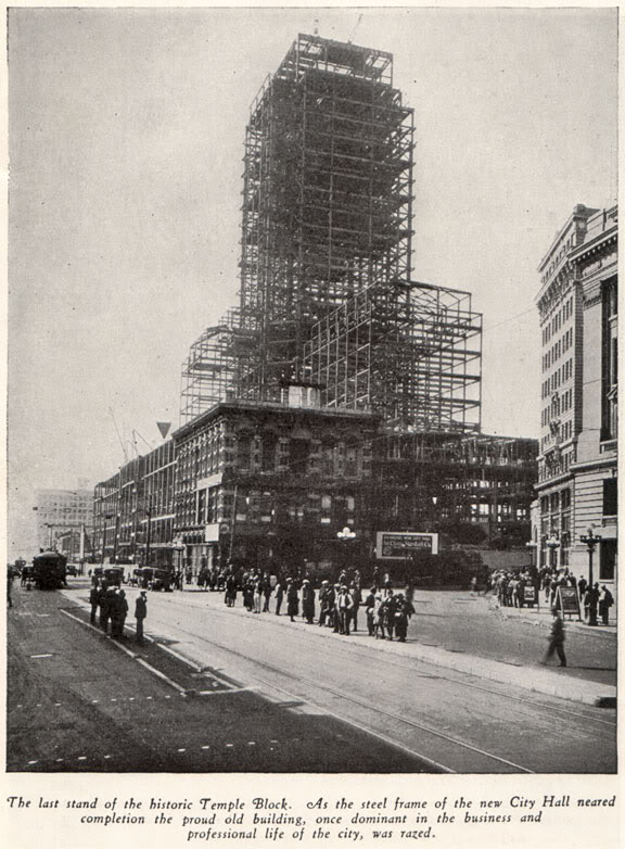
From "La Reina," published by the Security Trust and Savings Bank, Los Angeles, 1929.
In the center is the doomed Temple Block, truly dwarfed by the 1928 City Hall rising up behind it. Temple Square itself will cease to exist by the end of the 1930s. Today, there's no visible trace whatsoever that there used to be a large open downtown public square at Temple and Main Streets...
-Scott