Quote:
Originally Posted by ethereal_reality

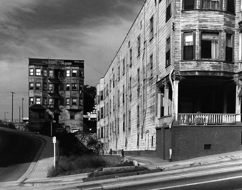
Olive near 4th Street in 1965.

LAPL |
While we're still in the area of 4th Street, I've been curious about the road on the left of the Olive Inn since I first saw this picture. That must be the rear of the Judd Apartments in the background.
My search for the mystery road led me to the 1972 Historic Aerials image below. It looks like the "S" shaped road provided access between S Olive and S Grand while the 4th Street Cut was being dug. I decided to include a larger area because of the details it shows. Pretty much all of the buildings mentioned in the last few posts about the 4th Street Cut have gone, as has Bunker Hill Avenue and the section of Grand Avenue between W 1st and W 4th. S Hope has a temporary jog around the under-construction Security Pacific Plaza (Bank of America Plaza).

Historic Aerials
Here are a few previous posts with images relating to this area:
gsjansen: 4th & Grand Service Garage looking across 4th Street in 1955 and 1956.
http://forum.skyscraperpage.com/show...postcount=4072
FredH: Casa Alta on Olive Street being demolished in 1966. The Olive Inn and Mutual Garage are in the background.
http://forum.skyscraperpage.com/show...ostcount=18863
FredH: Close-up of the Olive Inn with the 4th & Grand Service Garage in the background.
http://forum.skyscraperpage.com/show...ostcount=18874
Flyingwedge: Some great, large, color aerial views of Bunker Hill, circa early 1969.
http://forum.skyscraperpage.com/show...ostcount=19714