Quote:
Originally Posted by ethereal_reality

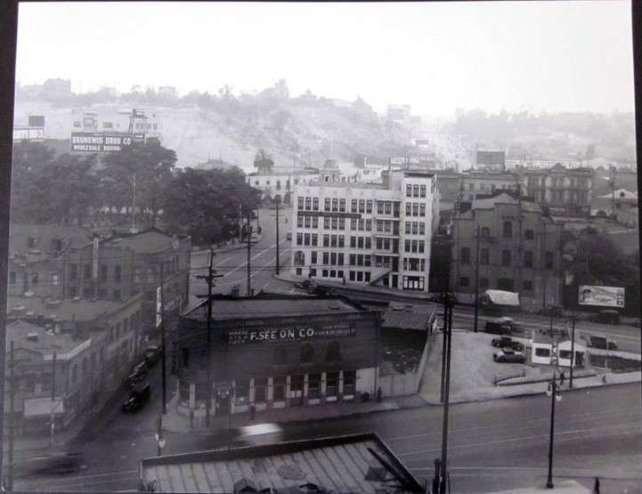
I found this on ebay tonight.
We've seen similar views early on in the thread but I don't remember the various signs like the Brunswig Drug Co. billboard.
ebay
I should be able to pick out these streets but I'm not 100% sure, so I checked my old map.
1947 map

alas, it's still confusing to me. Is that Sunset curving around The Plaza onto Sanchez? how about Alameda St?...
and then there's Ferguson too.
OK. Here's my guess...the photograph shows Ferguson, Olvera and Alameda...with Sunset on the far side of The Plaza
__ |
This should help:
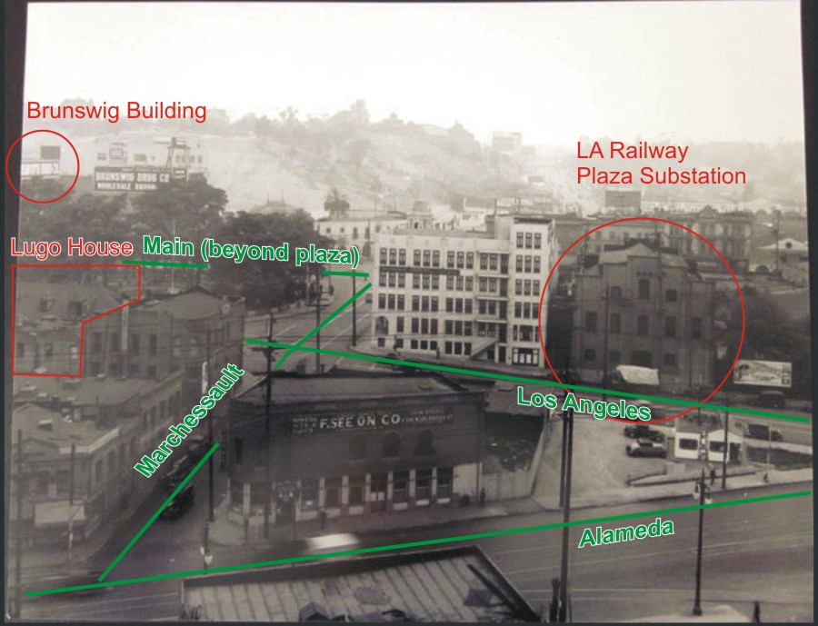
The view is looking west, basically from the viewpoint of what would become the main entrance of Union Station. I have marked the plaza substation and Brunswig building that are still there today, and the Lugo house which we are seeing from the back. The Plaza church is obscured by all the trees of the plaza. The building with the biggest Brunswig sign is just south of the Plaza church - an area which is now an empty lot. (It might even be the backside of a building which faced New High Street.) The recently-restored Brunswig building is a couple doors to the left, and is just barely visible at the left edge of the photo, with Brunswig lettering along its side. The Avila adobe would be just to the right of the substation, but you can't really make it out. The white building on the left of the substation is the Mexican Cultural Institute building, formerly the Mexican Consulate, which has been remodeled into something better fitting the area, including the addition of an arcade along the Los Angeles Street side.
Quote:
Originally Posted by shadyguy
Hello All, my name is Brad and Live in Tulsa. I have been studying this site for nearly 2 years with no intention of ever joining but just learning as much as I can of L.A. !
The reason I joined is because there is something driving me crazy dealing with the tunnels. At the intersection of Hill & Temple on the NWC (?) there is a single tunnel heading north. Someone please tell what this tunnel is and where does it come out ?
|
Welcome, Brad! I believe the tunnel you're thinking of was a streetcar tunnel that curved northwest under Fort Moore Hill and came out on Sunset. On ethereal_reality's 1947 map inset, quoted above in this post, it is along the red dotted line on the left. The streetcar line went up Hill Street, passed under Court Street in a double tunnel (one for rail, one for cars), then at Temple it diverged from the street and only the rail line went into a second tunnel, passing under Fort Moore Hill to come out on Sunset. Part of the old tunnel, under school district land, was used for school district archive storage until 2004.
Edit: it took me so long to make the graphic and the post that most of what I wrote has already been posted! D'oh!