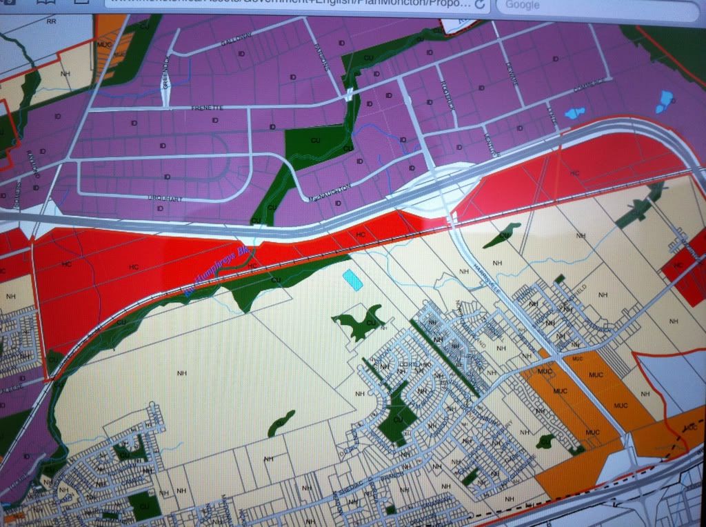
This map is part of the "Future Land Use Map" from the "Plan Moncton" document. It covers the Harrisville/Lewisville area.
Two things of note that I found interesting:
(1) - The entire south side of the TCH opposite the Caledonia Industrial Park will be designated "Highway Commercial" (coloured red).
(2) - There will be a section designated "Mixed Use Commercial" (coloured orange) on the southern end of Harrisville Blvd adjacent to the Rt 15 interchange. This is where the Fairfield Inn is being built and also encompasses the rumoured location of a new retail plaza anchored by a Sobeys. This land (on the northeast corner of the Rt 15/Harrisville interchange is already owned by PlazaCorp.