Responding to the comments about my New Years Eve photo post…
I'll start with my so-called "Mystery Building". Hoss C wrote:
Quote:
Originally Posted by HossC

With reference to 3940dxer's very interesing post about the New Year's Eve, 1951 picture, I think that mystery building #15 was just south of the current site of the Twin Towers Correctional Facility you mentioned.
Detail of picture posted by 3940dxer, original from USC Digital Library
Here's a closer view which also shows Little Joe's in the foreground.
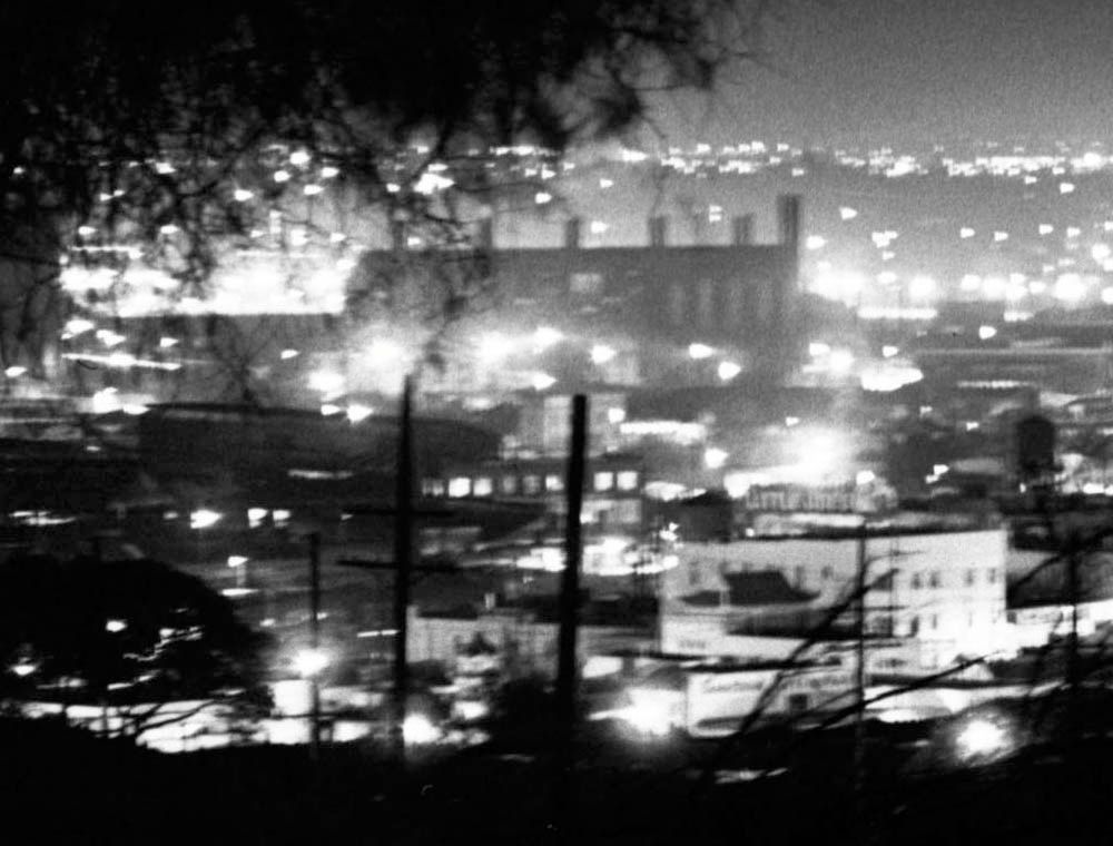
Detail of picture in USC Digital Library
I believe the mystery building is shown in 3940dxer's picture of the gasometers. It certainly seems to have the same five light-colored cylinders in front of the main structure. The source document names #2 as the Southern California Gas Co Plant. The street passing to the left was Macy Street at the time, it's now East Cesar E Chavez Avenue.
 ctr.trains.com
 (PDF file)
The structure was discussed at the beginning of July. Here's a picture I posted in post #22393 which shows the chimneys better.
Detail of picture in USC Digital Library
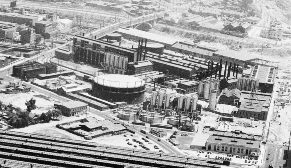
The gas plant is roughly in the center of this 1952 aerial view, which is very close to the date of the original USC image. The large gasometers and their long shadows can be seen at the bottom.
Historic Aerials
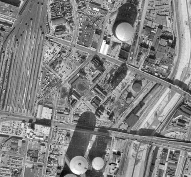
The area is now occupied by the C. Erwin Piper Technical Center and the Gateway Center (Union Station MTA Garage), built over Howard Street and the northern section of Center Street. Part of the Twin Towers Correctional Facility is visible at the top of the aerial below.
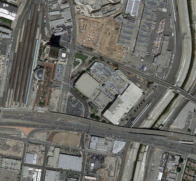
Google Maps |
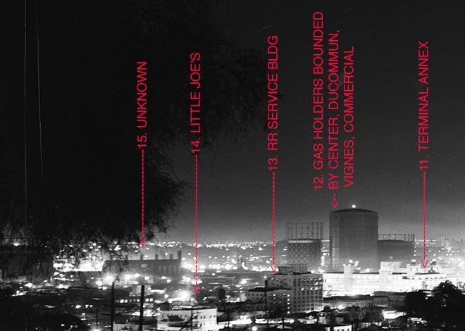
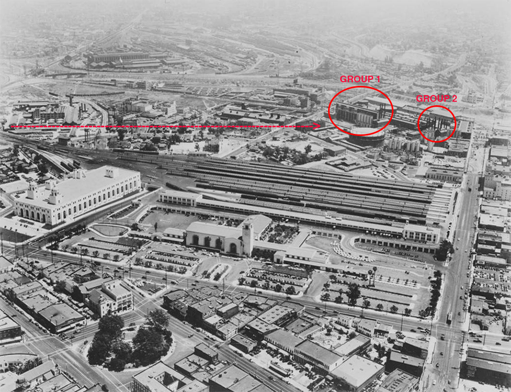
This location certainly agrees with the sight lines that I came up with and we agree that the chimneys are about where the Twin Towers jail was built. In the 4th image that HossC included, we see that there are several groups of silver or light colored vertical tanks, and two groups of black or dark colored chimneys, which I've marked on the image below, along with a dashed line showing the
approximate sight line from the photographer's location. The arrangement of the black chimneys in Group 1 (near the southwest corner of Keller and Macy/Sunset) seems to match the original photo reasonably well. So while it's hard to be sure, I think I agree with HossC's conclusion and it appears that we're seeing that my "mystery building" is this plant, with the silver tanks in the foreground on the right, the building behind the silver tanks, and the dark colored chimneys behind the building. Thanks for helping with this, HossC.
 http://digitallibrary.usc.edu/cdm/fu.../rv/singleitem
Now…Michael Ryerson and ProphetM commented on Michael's post of 5-1-13, in which he concluded that the Sunset and San Fernando hotels were both reduced to one story, but do survive. I had forgotten about these posts, but they were carefully documented and it seems sure that the lower floors of these two old buildings do indeed still stand, which is nice to know. I've edited my original post accordingly. With a little luck, we'll be able to see either or both in my "now" version, which I'll post soon.
Finally, Alvaro Legido wrote "I don't know how to research on the Thread, but I remember well that a similar attempt to locate where the photographer was has been done by MichaelRyerson. It would be very interesting to compare the results of these two amazing posts."
I couldn't fine Michael's post here either, but he sent me a link to this image, which may have appeared in his NLA post:
 https://www.flickr.com/photos/michae...778552/sizes/l
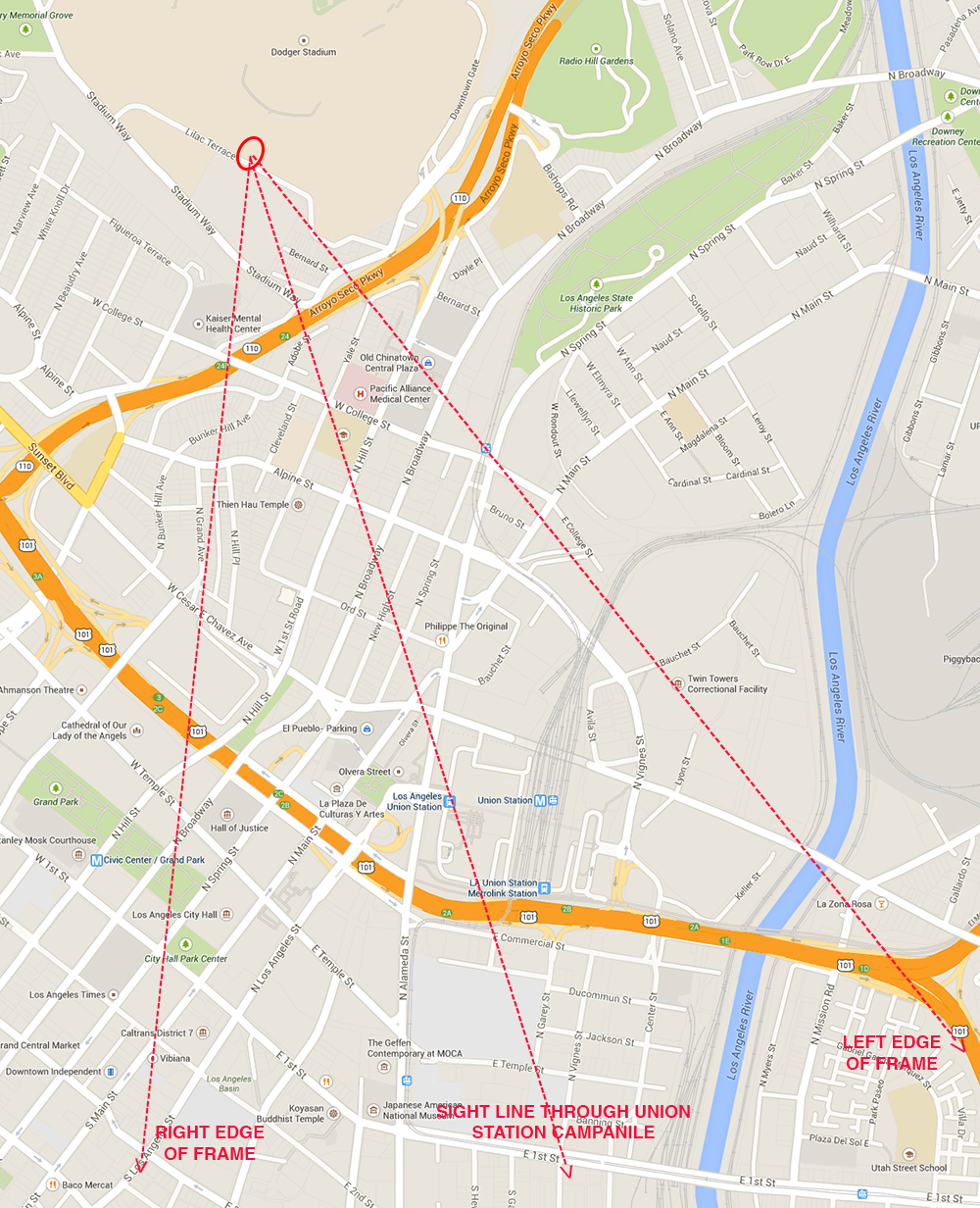
Here's a more finely tuned version of the location map in my first post. I believe that the original photographer stood somewhere within the ellipse. I've added sight lines indicating the approximate left and right edges of the original shot, and a sight line towards the Union Station campanile clock tower, which is near the enter of the photo. If Michael's sight line is extended towards Dodger Stadium it lands within a few hundred feet of my elipse, so for all practical purposes, we are in full agreement.
 https://www.google.com/maps/@34.0452...18.2232483,12z
My next post will include at least one"now" version of the original photo, with a discussion of how this scene has changed over the past 63 years.
Meanwhile, can anyone identify any more of the buildings in the original photo?