Quote:
Originally Posted by ProphetM

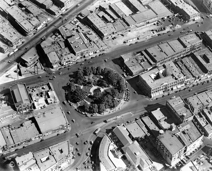
Here's an aerial from the other direction:
lapl
Marchessault goes out of frame at an intersection at bottom center; it apparently stops being called Marchessault at this intersection. Marchessault essentially becomes Sunset, proceeding straight down out of frame and connecting with modern-day Sunset at Broadway. The street proceeding down and left out of frame is Spring Street.
This indicates that sunset did indeed go all the way to the plaza, at which point it became Marchessault. |
Excellent photo :-) No Mexican Consulate. No forbidding Methodist church. And the Plaza church looks much cozier with neighbors. It's sort of awful now left out in that sea of street-level parking all by itself. It got its own fantasy Spanish makeover.
I thought that the Machessault/Sunset name changeover came at the NE corner of the Plaza. Actually it does in the Gillespie's Guide, but Marchessault had been torn down by then, so the name was gone and Sunset was just finessed between the Plaza and Olvera St. I also thought Los Angeles Street ended at the SE corner of the Plaza when it turned into that big parade ground (or whatever it was used for). I
knew Ferguson was in a line with the north facade of Pico House, that's how I usually identify it in aerials, but I just got lost this evening.
Lugo House was a stupid loss. And for what? An unused patch of grass. Same with Ferguson Alley. There's nothing there.
Do you know when the Plaza was closed to east/west traffic?
That's a gorgeous map too. I'm saving that. Thank you
ProphetM.