Quote:
Originally Posted by ethereal_reality

I found this photograph in an old file of mine.
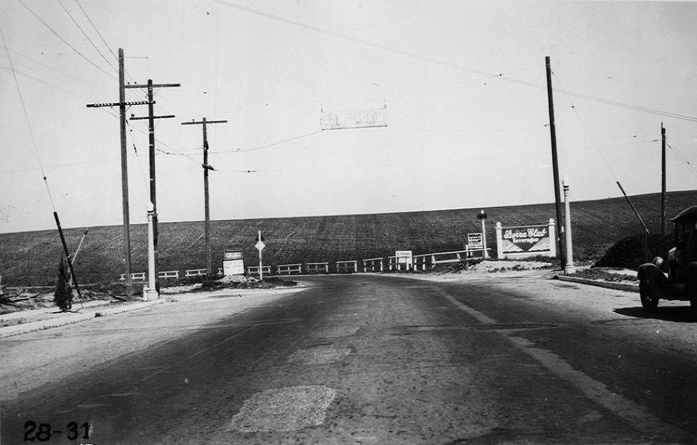
-labeled dead man's curve, main street in El Segundo, 1928. |
A zoomable version of the picture above is available at the
USC Digital Library. They describe it as
"Death Curve" on Coast Road at north city limits of El Segundo, from center line of Main Street south of Collingwood Avenue, El Segundo, looking north, Los Angeles County, 1928. I see they put a sign over the road saying "Come Again" - maybe the curve wasn't that deadly

.
The earliest image at Historic Aerials is 1953. I've arrowed what I think must be the curve in question. The street it connects with is Main Street.
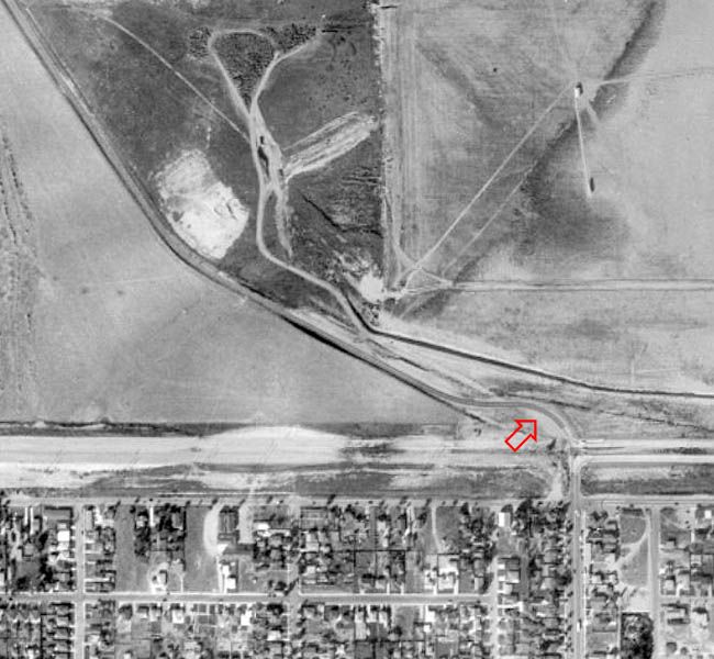
Historic Aerials
By 1972 the runways have grown, but the original road is still there.
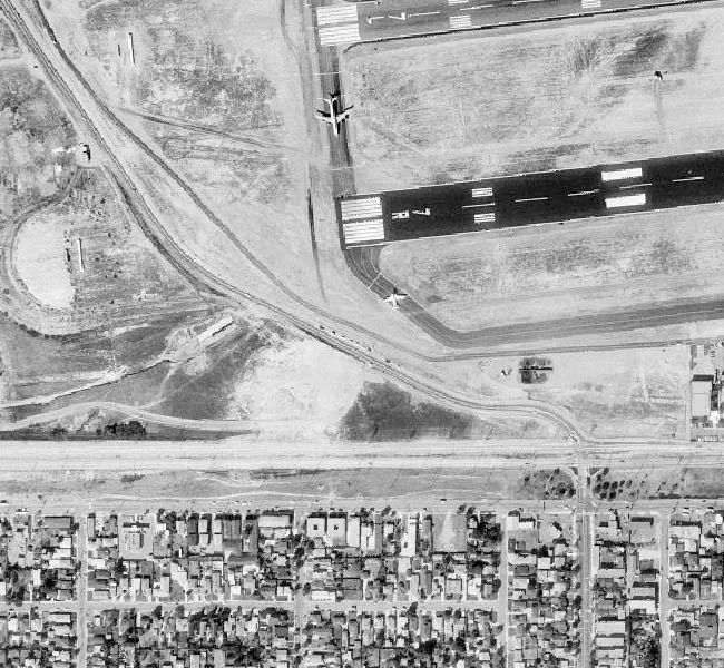
Historic Aerials
You can still see where the old curve was in this 1980 image, but the surface seems to have been dug up. The upper part of the old road looks like it was incorporated into a perimeter road for the airport.

Historic Aerials
The Historic Aerials images from the 2000s look pretty similar to the current Google Maps image below. An extra taxiway has been added between the runways, and the road at the western end has now been re-routed. I've arrowed the short straight section which appears to be the only part that still follows the path of the original road.
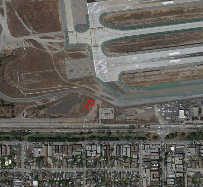
Google Maps