Quote:
Originally Posted by GaylordWilshire

 LAT
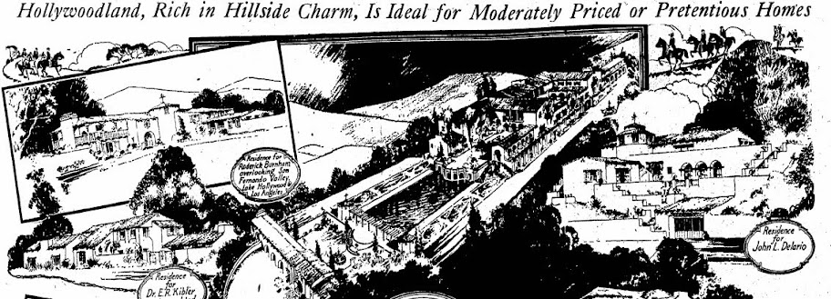
LAT Sept 20, 1925 |
 http://jpg1.lapl.org/pics16/00007567.jpg
 http://jpg2.lapl.org/pics04/00011571.jpg
Cue the shovel nymphs. And, action!
 http://jpg2.lapl.org/pics04/00011573.jpg
1924
Western Construction
 http://jpg1.lapl.org/pics16/00007576.jpg
 http://jpg2.lapl.org/pics04/00011577.jpg
 http://jpg2.lapl.org/pics04/00011558.jpg
 http://jpg2.lapl.org/pics04/00011565.jpg
 http://jpg2.lapl.org/pics04/00011553.jpg
??? Dana Point and Hollywoodland?
 http://jpg1.lapl.org/pics16/00007573.jpg
 http://jpg1.lapl.org/spnb01/00007120.jpg
_______________________________
And the confusion continues. . . . . .

1937 - "Panoramic view
of Mount Lee and the Hollywoodland sign from the peak of Mount Hollywood."
 http://jpg1.la
pl.org/00098/00098470.jpg
Quote:
In 1923 Harry Chandler's real estate development Hollywoodland was loosely bounded by Mullholand to the west, Hollyridge Drive to the east and Belden Drive to the south. The Hollywood Sign located on the top of Mount Lee was declared Los Angeles Historic-Cultural Monument #111 in 1973.
The Hollywoodland sign can barely be seen on the left side of Mount Lee in this view taken on a Hollywoodland hike. http://photos.lapl.org/carlweb/jsp/F...Number=5092980
|
 http://jpg1.lapl.org/00098/00098990.jpg
Quote:
|
Aerial photograph capturing the Hollywood Hills, Mt. Lee, and the Hollywood Sign; various homes are seen throughout the image.
|
1992
 http://jpg1.lapl.org/00102/00102565.jpg