Quote:
Originally Posted by Will O' Wisp

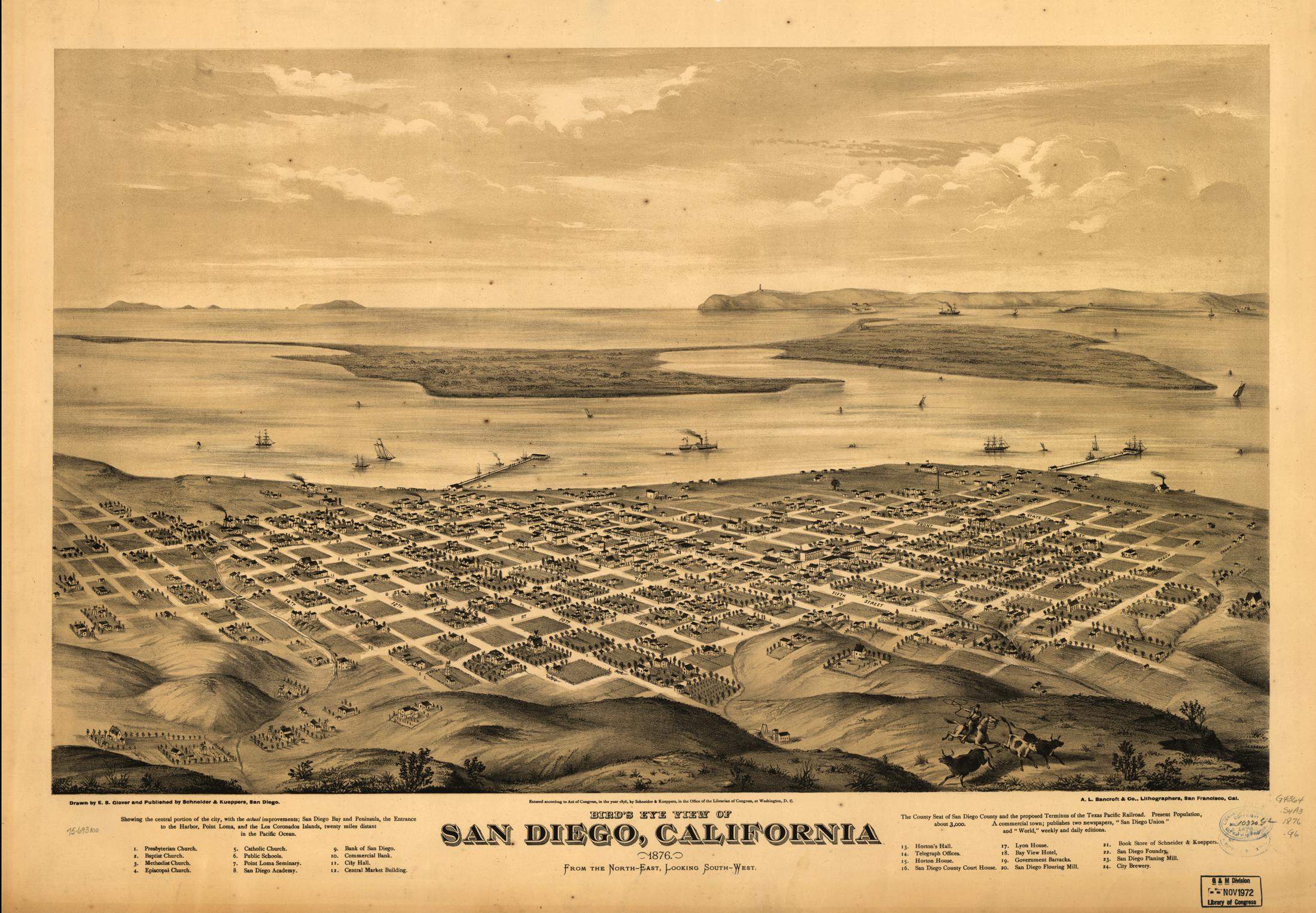
For a change of pace, how about this map of downtown circa 1876. I just love all the detail. (warning: large image)
The city is depicted from Balboa Park, and for reference the view to very similar to what you see today while coming into land at the airport. As far as I can tell it was commissioned to draw up support for extending the southern transcontinental railroad to the harbor, which would have made San Diego the port of entry for all of southern California. Unfortunately geography dictated the railroad swing north to Los Angeles instead, which lead to LA becoming the region's commercial hub instead. |
I’ve read that it was due to city officials in San Francisco fearing San Diego’s harbor rivaling their own and didn’t want SD to compete with SF. So being the premier city at the time, they decided on the small cow town Los Angeles with no competing harbor back then to be the terminus of the railroad. As Los Angeles boomed throughout the years especially with Hollywood attracting stars, the city extended city limits all the way to San Pedro in order to have its own harbor and port. By around the 1920s, Los Angeles had completely taken over San Francisco and the entire west coast as the premier city.