probably just the latter......
Street and road systems were pretty local and haphazard affairs 120 years ago (an alley behind someone's dairy farm attracts more traffic, it is widened, another street is cleared parallel to the original, which intersects with an existing road at an angle seen only in geometry textbooks (e.g. Ceres and Central).....

You needed a relatively strong city government to impose some order on things, which you didn't get until......1890 or so?
Quote:
Originally Posted by tovangar2

Checking out the relationship between the Santa Fe Station (upper right) and the Arcade/Central site (lower left) on the 1909 map, I got focused on the out-of-kilter block directly between them:
It's still there:
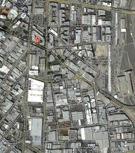
google maps
I was wondering if it was an old estate, a hold-out or even a hill, but I cannot find an older map that solves this one for me. It may just be the result of two grid systems crashing into each other as the city grew. |