Checking out the relationship between the Santa Fe Station (upper right) and the Arcade/Central site (lower left) on the 1909 map, I got focused on the out-of-kilter block directly between them:
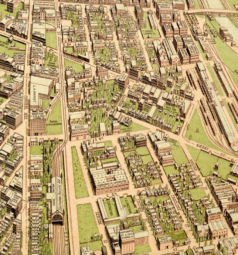 http://www.bigmapblog.com/2011/birds...f-los-angeles/
It's still there:
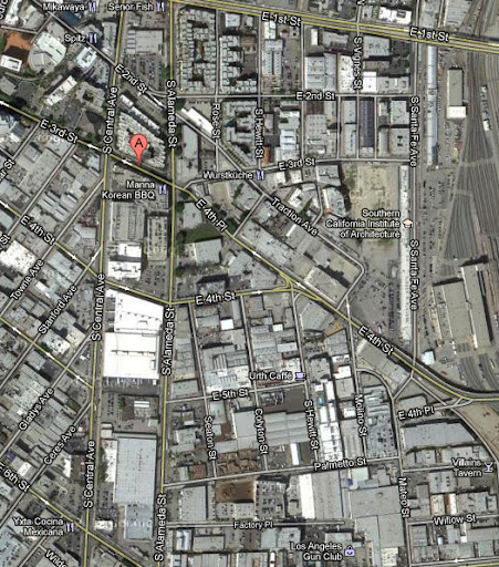
google maps
I was wondering if it was an old estate, a hold-out or even a hill, but I cannot find an older map that solves this one for me. It may just be the result of two grid systems crashing into each other as the city grew.