East London Line Extension
Pictures provided by TfL, sourced from londonreconnections.blogspot.com
Dalston Junction - 4 platform station. The platforms are located under the concrete slab. Residential developments are planned on either side of the submerged line, which will have a park running above.
 Hoxton Station
 - Moving southwards towards the Square Mile, we come to Hoxton Station which shows the incorporation of the historic brick viaducts and the modern track.
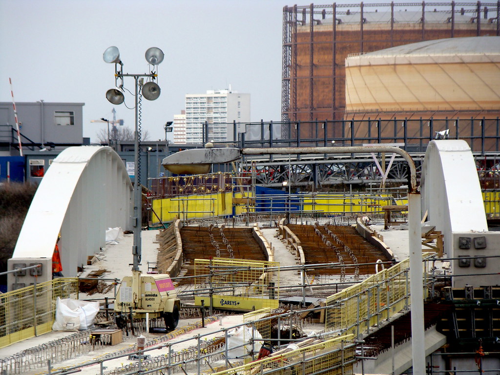
 Shoreditch Station
 - While above ground, Shoreditch station will be a fully enclosed structure. This box is intended to protect those using the station while several tall buildings are built above and around the station, essentially enclosing it.

The outside illustrating the enclosed elevated station

The bridge that connects Shoreditch station and the old East London Line further on, with the old Broad Street viaduct pictured in previous images
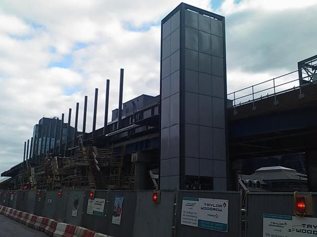
 Whitechapel Station
 - New access stairway at the end of the ELLE platforms. Whitechapel currently also serves the Hammersmith & City and District lines. In 2017 it will also serve the Crossrail line.


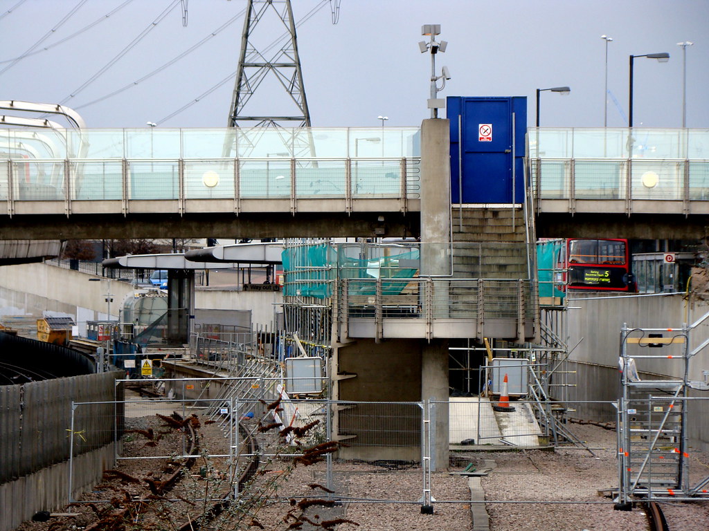
 New Cross
 - South of the Thames, the ELLE will take over local stations to West Croydon ensuring that other train services can provide express services to Central London. This image illustrates a fly-over in New Cross to ensure that services don't conflict.
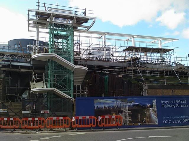
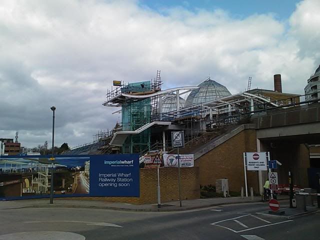
 Imperial Wharf Station
A long delayed station on the West London Line. Pictures by
irstan74 on SSC.
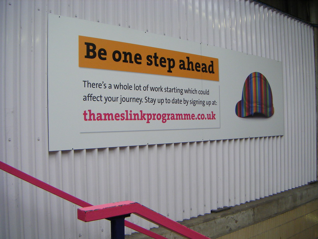
 Thameslink Programme
Thameslink is a massive multi-£bn project to create a 24tph central corridor line that connects commuter settlements to the north and the south. Due to the complexity of the project (it could be argued more so than Crossrail due to the immense station rebuilds required), it has been divided into three Key Outputs as to not conflict with other transport projects and the 2012 Olympics.
Key Output 0 - Going live on the 22nd March will see additonal services running through the central corridor providing 15tph.
Key Output 1 - The main product from this scheme will be to enable 12-carriage trains to run across the majority of the network, which also includes the complete re-building of Farringdon and Blackfriars
Key Output 2 - The final phase will see London Bridge station completely rebuilt in tandem with the final construction on the London Bridge Tower, and the finalisation of the 1,100 new carriage order supplied. The peak capacity of the Central London route will be 24tph.
The map of the Thameslink network at Key Output 0 is below. Map and picture by
mackenzieblu (flickr.com)

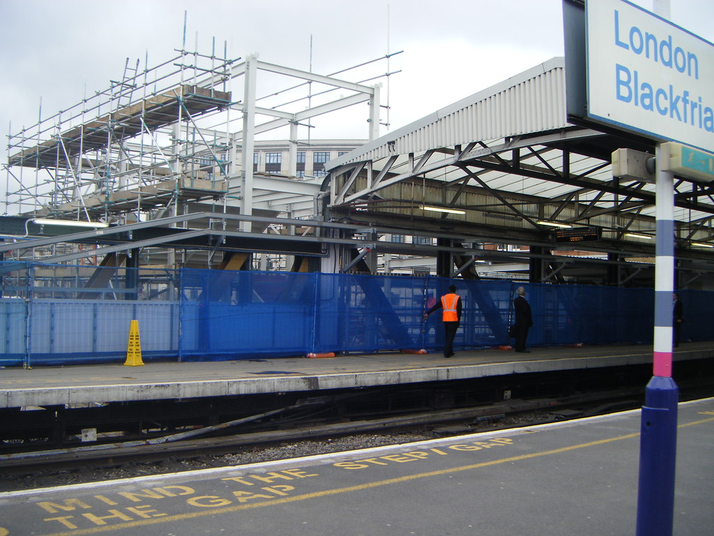
The rebuilding of Blackfriars - note the new entrance to help during the rebuilding (the Underground station below ground will be closed to help construction) - also of note is that the gap in the background is where Thameslink crosses the Thames - the new station will span the entire length of the river.
The below map is from Joe Brown's London Railway Atlas illustrating the railways around St Paul's and the Thameslink line which runs north to south.
Its an excellent book, now on its second edition (London's railways don't stop changing), if you're a rail nut and want an atlas on all of the railways in London, pre-order it now!
http://www.amazon.co.uk/London-Railw...7151260&sr=1-4
 Britain's Biggest Bus Garage
On a massive site in East London, close to West Ham station, and south of the Olympic park a vast new bus garage is being built. With a capacity for 300 buses, and 650 drivers, the building resembles the barrel-vaulted Victorian train stations or a time gone by. The modern adaptation however is to cover the entire roof with grass, and incorporate a biomass generator and wind turbines to create a depot with probably the greenest credentials.
Picture from londonreconnections.blogspot.com
 London - Harder, Better, Faster, Stronger
David Hubert has compiled an amazing video of some 3,000+ photos taken in London.... definately worth a glance.
http://vimeo.com/2169237
Future Circle Line
On the present tube map, the Circle Line is represented as a yellow circle, but there are several issues with he service which impact its performance. To overcome this issue, the Circle line will be re-worked to run from Hammersmith, go around the present Circle line route, but terminate at Edgware Road instead of continuing to go around and around.
The situation should ensure that the service is more efficient, although it could become a bit confusing for those at Edgware Road, where you could get four Circle Line trains in the station at the same time (a similar issue as found at Earl's Court where all the district line spurs converge).
Mackenzie Blu on his flickr account has drafted a tube map (minus National Rail and DLR lines) illustrating the change.
 DLR Updates
South Quay Station
DLR Updates
South Quay Station - Work progresses on the new South Quay DLR station. Picture by
sirstan74
 Tower Gateway Station
 - Now re-opened, this former two platform terminus station has been re-built to allow for passengers to board from both sides, which will allow for an increase in capacity on the line. Pictures by
bowroaduk from flickr.
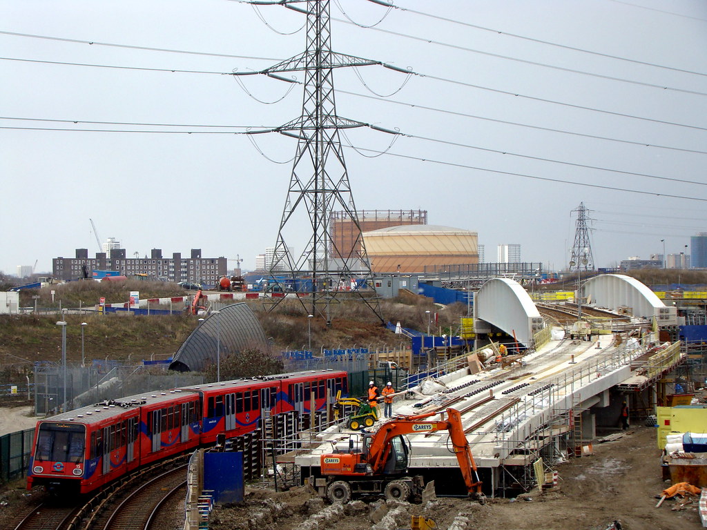
 Stratford International Extension
 -
Pictures taken by
kpmarek on flickr.
 London Overground
Here is an interesting map of the London Overground services, including the East London Line Extension, but not including Phase II of the ELLE which should be built by 2011. Phase II would leave Surrey Quay to the bottom of the map and link Clapham Junction on the right spur, effectively creating a complete orbital service bypassing Central London.
